A lovely landscape forms the area Ostallgaeu.
A lovely landscape forms the area Ostallgaeu. In the south it comprises the foothills of the Alps and the Alps and in the north the Swabian-Bavarian plateau. The lowest place of the district is located at Lamerdingen with 578 m. It is an alpine area, which rises up to 2082 meters in the Oberammergau Alps. Many lakes characterize the foothills of the Alps. The Most Famous and largest is Lake Forggensee.
The administrative district of Ostallgäu, with its approximately 135,000 inhabitants, lies in the southeast part of the Bavarian governmental district of Swabia. Comprising 45 municipalities, Ostallgäu is right at the edge of the metropolitan area Munich and Augsburg. Seat of administration is the city of Marktoberdorf. The mountain range Ammergebirge and the Tannheimer Mountains are located in the county’s south, whilst the north consists of typical pre alpine countryside with its ponds and lakes.
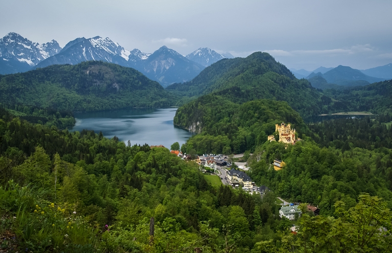
Next to industry and services, agriculture and tourism build the foundation of the region’s economic impetus. Thanks to its various castles and palaces, the Ostallgäu is also called county of castles. The royal castles Hohenschwangau and Neuschwanstein are two of Europe’s most popular tourist destinations.
Photo: Hohenschwangau, siete_vidas/Shutterstock